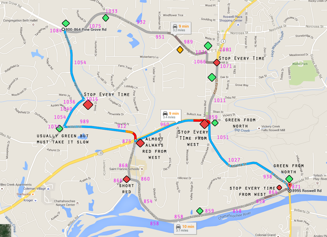
On my way to work I have to make it from the top left corner heading East on Pine Grove Road to the bottom right corner on Atlanta Street. My commute doesn't start or end there, this is just a case of different routes I can choose for this part of the drive. I want to choose the route which results in me burning the smallest volume of gas.
On the plus side: There's usually no traffic as I work at funny times, so I don't deal with rush hour.

As Google Maps shows, the top route is the shortest, the middle route is probably the fastest, and the bottom route is the longest.
█ This pinkish colour is elevation in feet. █
However, there are some traffic lights and elevation changes which makes this commute a difficult decision. On my map I drew in traffic lights. Red means I almost always need to stop, green means I almost always get to go, and yellow means it's a tossup. I'm driving the Insight which does have working Auto-Stop, so the lights aren't terrible, but the stop and go means decel then accel again.
Right now I almost exclusively take the bottom route because of elevation. As you can see, once I get down the hill it's mostly flat until a slight rise at the end. However, you can also see that I have to stop more frequently on this route, and it's half a mile longer.
I kinda doubt the route Google gives is the best route because you have to stop at the bottom of a big hill and then climb back up the other hill and stop once again. But the top route might be a contender because it is shorter and I'll usually only have to stop once up in the top right corner.
What do y'all think are the most important factors here?