Quote:
Originally Posted by redneck

Budget constraints ? It seems youre making excuses for them for not showing the historical trend in sea rise levels.
I found it in less than a minute. Unfortunately, it only goes back to 1992 when the satellite first started taking measurements.
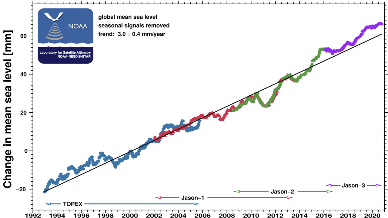
It shows a steady incline. No sudden changes. No sudden rise. No hockey stick.
But guess what. They have already adjusted data for at least one variable. And a significant one at that.
In one of the previous locked threads I posted a article that said they had a serious problem with the algorithm programmed in the first satellites measurement equipment and that the data may need to be scrapped. But, adjust they did.
So, who even knows if the baseline or the new algorithm is correct.
Just remember ...
Data can be manipulated.
Just like votes...

>
. |
Like I said, we don't have enough reliable data to calculate back to the beginning of the Industrial Revolution. Earth is not what is was back then.
If you've kept abreast of the research, you will already know that.
You have access to the general circulation models right now. It's either 36,000-lines of code, or 36,000-pages of code. I don't have that figure with me.
I believe most of the data is in the public domain as well, and has been.
If you'd like to run the numbers, to satisfy yourself that bad actors haven't cooked the books, you're absolutely free to pursue that. Full transparency.
It's actually the only way to have a first-order-reality experience with it. Otherwise, you're leaving it up to the experts, and the other experts who checked the experts work.
For myself, I'm happy to defer to the experts.